4.0
501 críticas
Everyone
Calificación de contenido
194.1K
Descargas


Acerca de estas aplicaciones
Altimeter Mountain GPS Tracker descripción
Turn your smartphone into a multi-functioned altimeter. Our unique algorithms determine your elevation using three sources - the GPS system in your phone, network services, and when available, your device’s barometer. Our algorithm combines data from all three sources to give you the most accurate reading possible.Our app comes with a brand new independent application for Wear OS watch devices. You can easily track your hiking without using your phone and synchronize data afterwards to enjoy viewing your routes on a bigger screen!
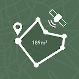
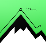
Know your exact heading on your current route, view your current position on the map and use the app to track any route you choose. The app tracks, follows and displays your route in real time, displays it and then draws elevation and speed charts during your trip. Kick back in your favorite chair after a long trip and view all of the adventures you’ve been on, our app automatically saves all of them in our database.
Tap or move your finger on or over any value on the chart to know when and where a particular value occurred. You can also choose from multiple functions such as speedometer, calorie counter, checkpoint times, notification sounds at preset milestones, and even auto pause should you decide to stop somewhere for coffee or to take a photo. If you do stop to take photos, they can easily be added with the data of your current position overplayed right on top! Your photos will have elevation, average speed, location info right on them!
Our app will also save all data associated with your account so that, should you choose to switch smartphones, nothing will be lost. Simply log in with the new device and pick up where you left off.
One of the coolest features of the app is that it divides your route into segments. In the segments screen you can see separate uphill/downhill data, you can easily check how long it took you to climb a mountain, your recent pace and elevation gain or how fast you went downhill later on. You can go into the details of the segment on the map, see a full chart and all data displayed on a list.
If you want to see your route in Maps or another application you can easily export track data to following formats:
- GPX
- KML
- KMZ
Terms and conditions: https://mysticmobileapps.com/legal/terms/altimeter.html
Privacy policy: https://mysticmobileapps.com/legal/privacy/altimeter.html