0.0
0 críticas
Everyone
Calificación de contenido
574.4K
Descargas


Acerca de estas aplicaciones
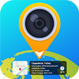
GPS Map Camera App descripción
GPS Map Camera App is the perfect tool for anyone looking to combine the functionality of a camera with the precision of GPS location tracking. Photo Map app is designed to make it easy to capture stunning photos while also tagging them with detailed geo location data. With GPS Map Camera, you can take advantage of features like geo tagging, GPS scanning, Geo location, and GPS Map Camera labels to create a visual record of your travels with GPS camera. One of the best things about GPS Camera app is that it offers a variety of options for capturing and tracking your photos with picture GPS locator or geo map. you can capture photos with photo location map. You can use geo location app to take photos with a built-in GPS camera, or you can add geotagging gps location data to existing photos using the photo GPS location feature. GPS Map makes it easy to geo tag all of your photos, so you can keep track of where you've been and when with photo map ( Photo Location ).Picture GPS locator in addition to its camera functionality, GPS Camera app also offers a robust mapping system that allows you to easily view your photos on a GPS map Camera. This feature makes it easy to see exactly where you took each photo with photo map, and it can be especially useful for surveying or documenting outdoor activities. With GPS Camera, you can easily create a photo map of all your adventures with geo map. GPS location stamp on the picture with longitude picture / latitude on picture with geo camera app.
Features:-
➥ Date & Time stamp formats and stamp it on Photo.
➥ Select and add GPS Location Automatic or manual
➥ Add GPS Map such as Latitude, longitude, and GPS address, with live GPS tracking
➥ Save your photo in accordance with custom names & live navigation
➥ Select a map type from normal, satellite, terrain, or hybrid
Geo location, GPS Map Camera is a powerful tool for anyone who wants to combine the functionality of a camera with the precision of GPS location tracking. Whether you're traveling the world, hiking through the wilderness, or simply exploring your own neighborhood, GPS Camera or Geo location can help you capture and GPS Map share your experiences with gps photo.
GPS Camera Map is a powerful and user-friendly app that helps users take geo-tagged photos, track their routes, and view their photos on a map. Picture GPS locator app is designed to work seamlessly with GPS-enabled devices, allowing users to capture photos with photo location data and view their gps photo on a map.
In addition to taking geo-tagged photos, GPS Camera Map also allows users to track their routes and view their photos on a map. The app uses GPS Picture to track the user's photo location and plot their route on a map in real time. Users can also view their photos on the same map, making it easy to see where each photo map was taken in relation to their route. you can use gps scanner as a survey cam. With GPS Camera Map, users can easily capture photos and add location information to them. Geo map app uses GPS to automatically tag each photo gps location with the photo location where it was taken, so users can easily organize with geo map and find their photos based on location. Geo location app also allows users to add custom notes and tags to their photos with geo tag, making it easy to find specific photos later on.
If you're looking for a lightweight GPS Map camera app, GPS Camera app Lite is a great option. Photo Map app or photo location offers many of the same features as the full version of GPS map Camera, but it takes up less space on your device. Whether you're a professional photographer or just someone who loves to capture photos on the go, GPS Camera and GPS map Camera Lite are great tools for anyone who wants to add geo location data to their photos.