3.9
91 críticas
Everyone
Calificación de contenido
9K
Descargas


Acerca de estas aplicaciones
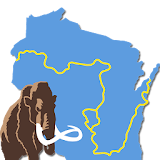
Mammoth Tracks - Ice Age Trail descripción
Please download "Guthook Guides: Hike & Bike Offline" to access the Ice Age Trail guide. Existing customers may transfer their purchases to the Guthook Guides: Hike & Bike Offline app.Mammoth Tracks is the official app for the Ice Age National Scenic Trail, built through a collaboration of the Ice Age Trail Alliance and the creators of Guthook's Guides hiking guide apps.
The Mammoth Tracks app is a GPS- and map-based guide for your Ice Age Trail hiking experience. Whether you're backpacking, or in search of IATA's Cold Caches, this app will help you plan your trip and check your location on the trail.
Key features:
- No mobile or internet connection is required after initial setup -- works in Airplane Mode
- Detailed maps with your GPS location
- Elevation profile view
- Custom route creator
- Multiple offline map choices
- Real-time comments from other hikers
- Send your current location to friends or family via text message or email
The guidebook lists every waypoint in order by distance along the trail and how far away you are from each waypoint. The guidebook also includes a detailed town guide for major resupply points, towns, and services along the Ice Age Trail.
Waypoint details include:
- Mileage point and elevation
- Photographs
- Distance to the next water source and tent site
- Comments section where you may post comments and read other hikers’ comments
Types of waypoints:
- Water sources (including the reliability of each water source)
- Detailed resupply and town information:
- post offices and other package services
- restaurants
- grocery stores and convenience stores
- gear shops and hardware stores
- laundromats
- lodging, public showers, public restrooms
- public libraries
- Tenting sites/camping sites
- Trail junctions
- Parking areas along the trail
- Picnic areas, campgrounds, ranger stations
- Roads, railroad tracks, power lines, fences, gates
- Natural landmarks (e.g. mountain passes)
- Privies/restrooms
- Views